Madison, WI 53705, U.S.A.
Phone: (608) 238-2171, Fax: (608) 238-9241
Email: info@powline.com
| Home | Search | News | Products |
|
|
610 N. Whitney Way, Suite 160
Madison, WI 53705, U.S.A. Phone: (608) 238-2171, Fax: (608) 238-9241 Email: info@powline.com |
|||
|
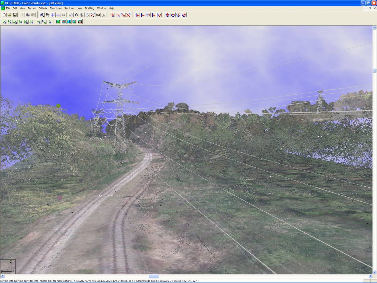
In July 2006 we added the ability to color code LiDAR survey points. The use of contrasting colors helps distinguish features in the LiDAR survey. The color can be supplied by your LiDAR provider or PLS-CADD can extract it from underlying aerial photography. Options for color coding LiDAR data are located in the Terrain/Survey Data Display Options dialog box.
The images below show the same LiDAR scene in black & white and in color from two different perspectives. The contrasting colors make it much easier to see wires and structures through the vegetation.
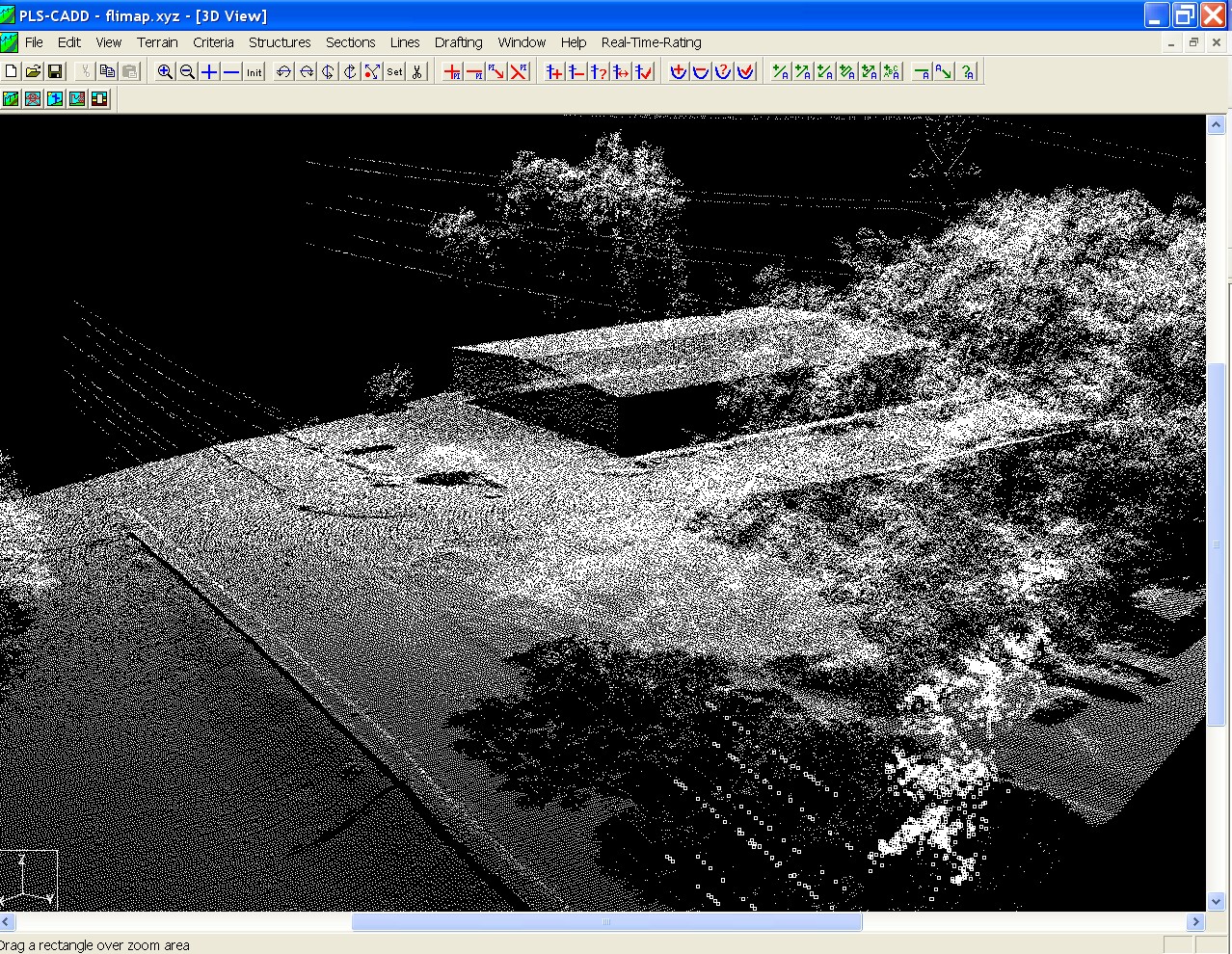
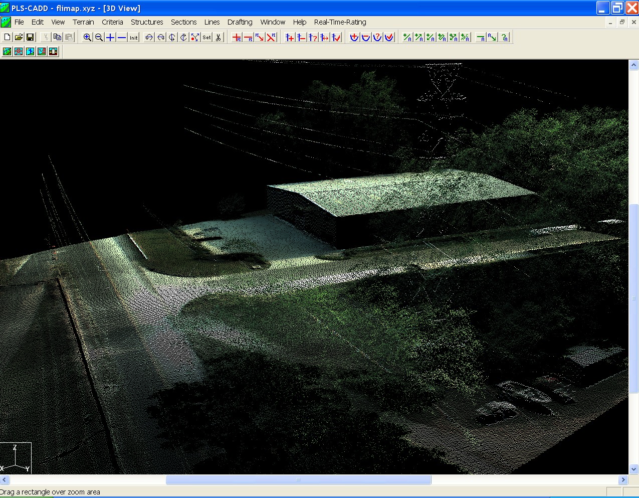
LiDAR data for production of images above courtesy of Fugro Chance Inc.
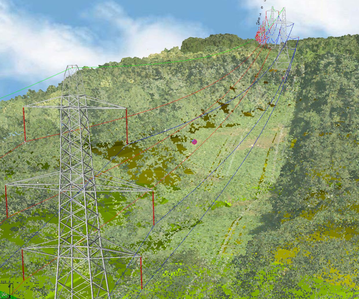
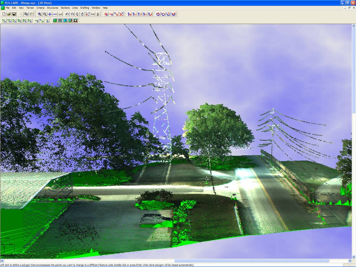
Image courtesy of Network Mapping.
LiDAR data for production of image above courtesy of Network Mapping
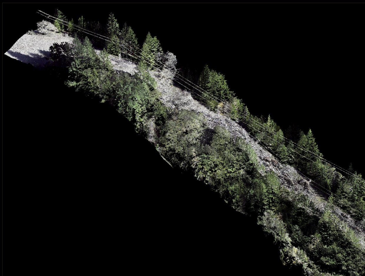
Image courtesy of Aerotec, LLC.
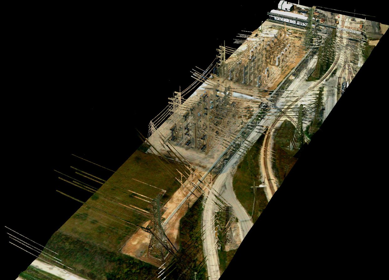
Image courtesy of Aerotec, LLC.